
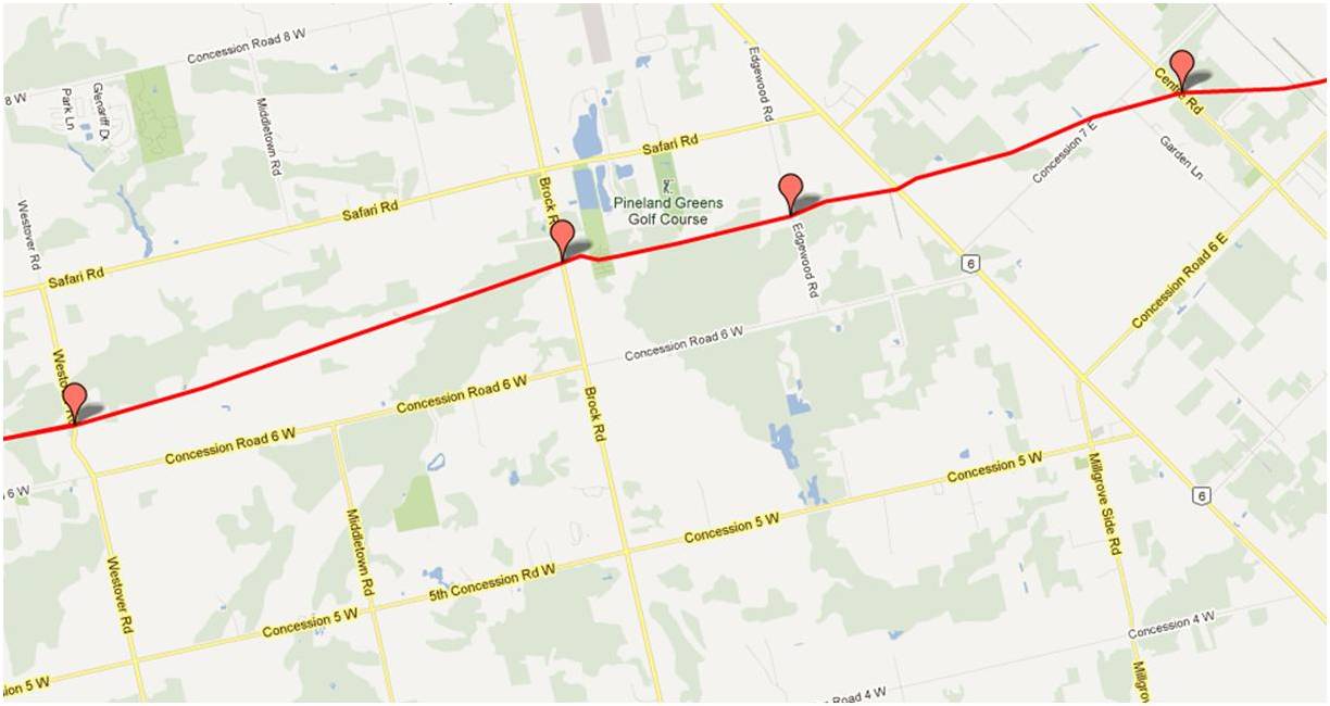
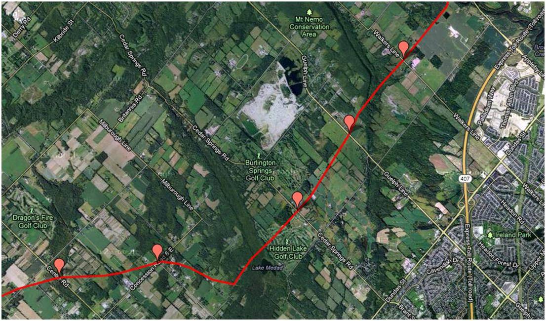
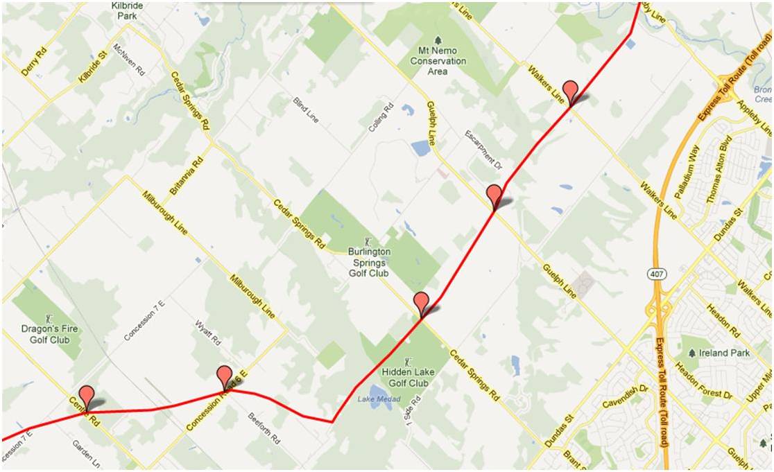
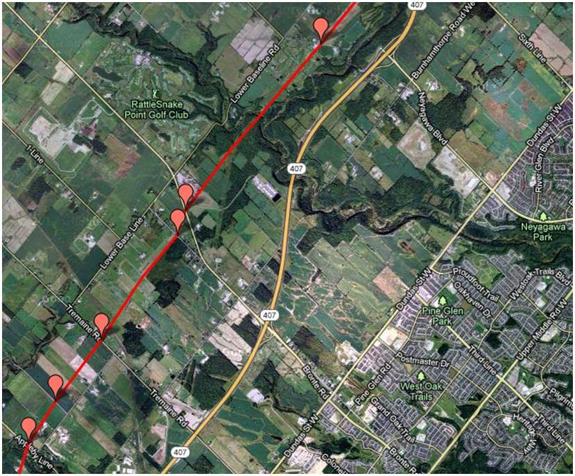
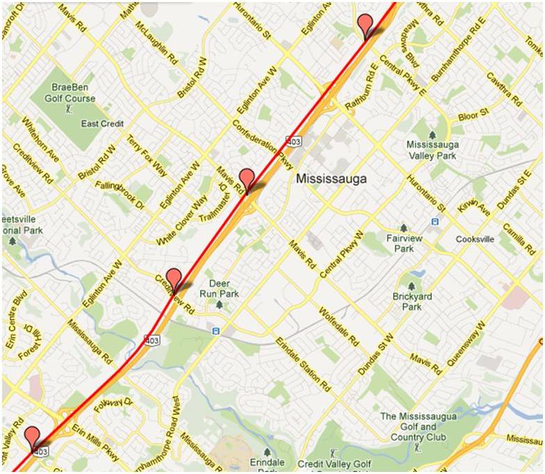
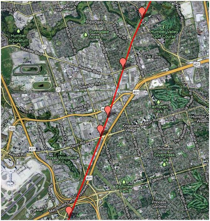
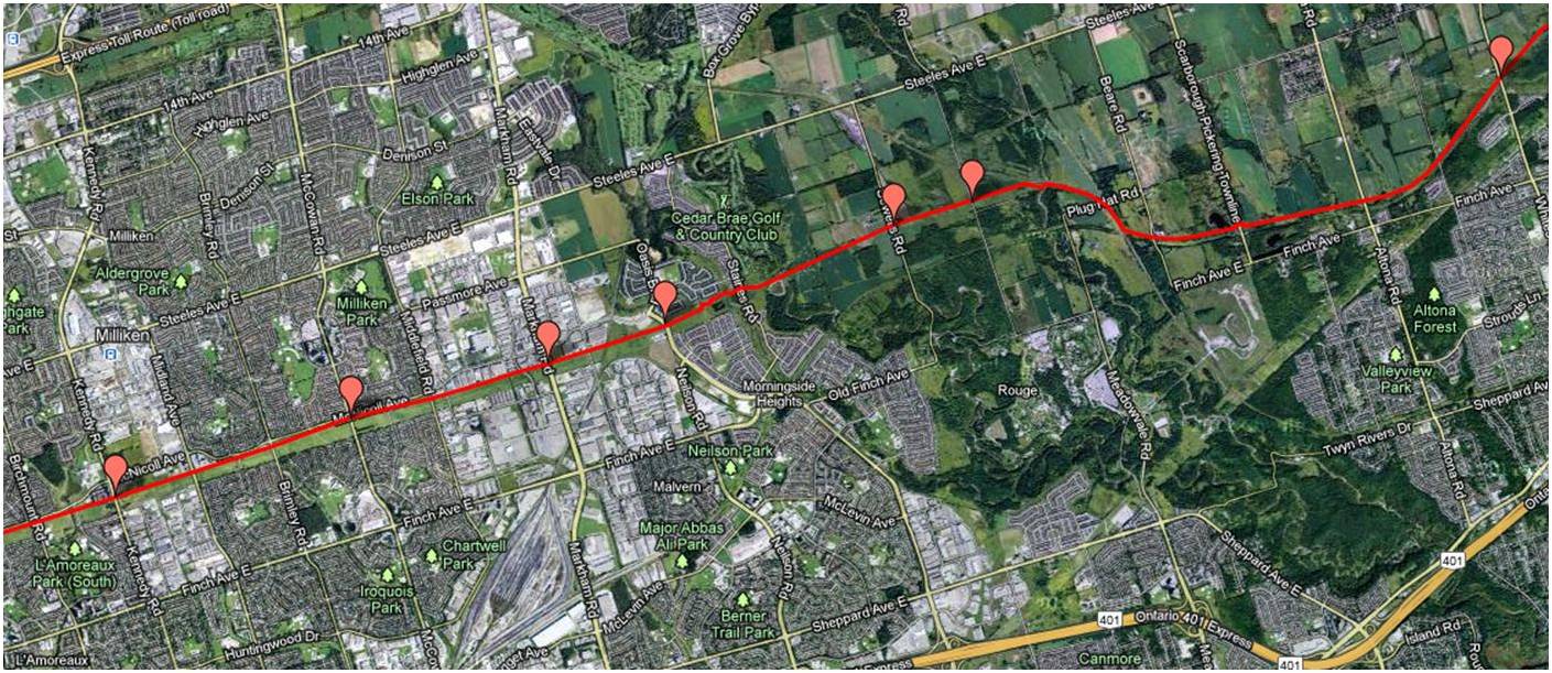
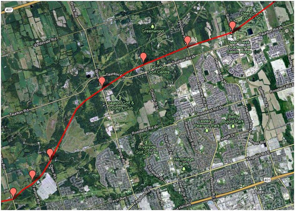
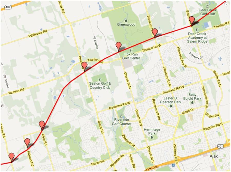
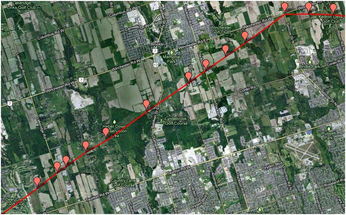
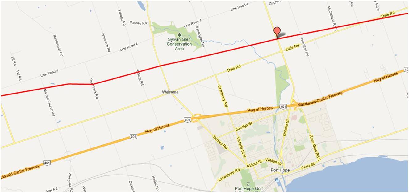
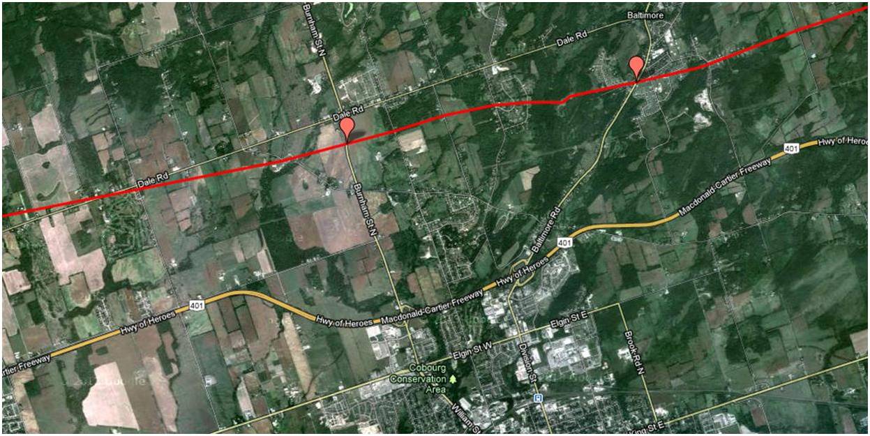
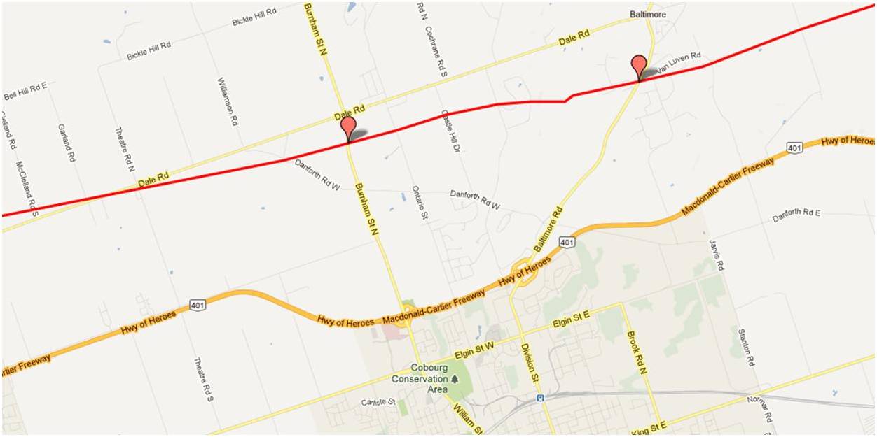
These maps were independently created and have not been verified by Enbridge. The margin of error over the entire pipeline is less than 1 km when compared to Enbridge maps submitted to the NEB. Red placemarks are pipeline verification points (road crossings). Maps are posted in a West to East direction.
Click Maps to Enlarge
Flamborough (Hamilton)

Burlington
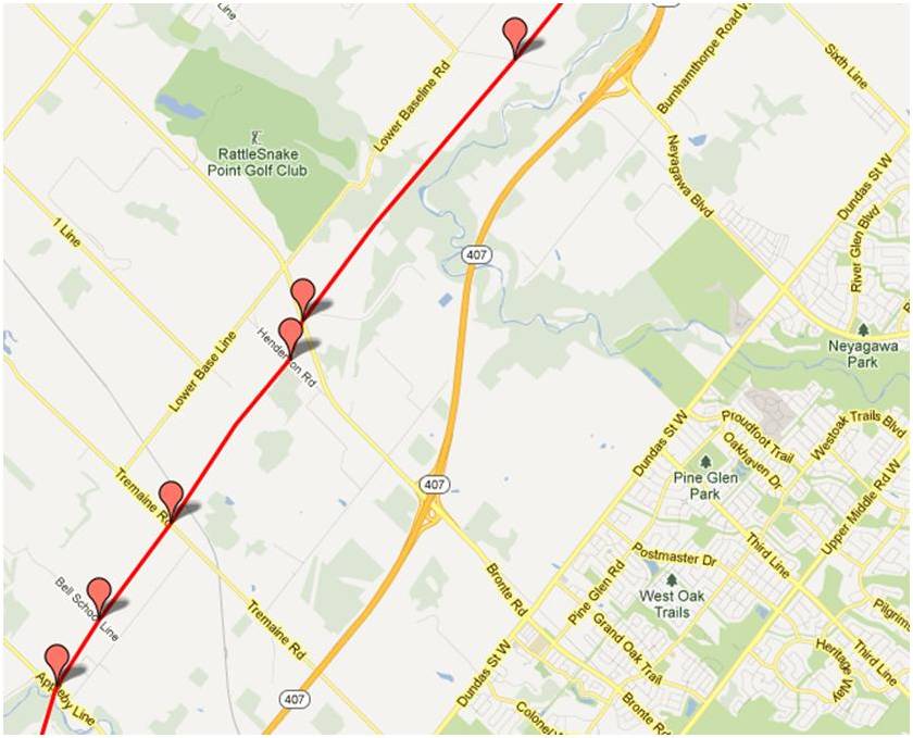
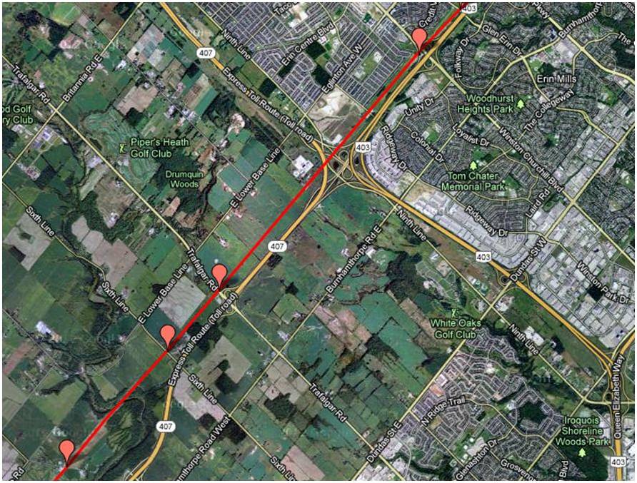
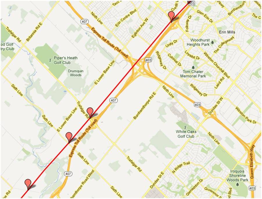
Oakville
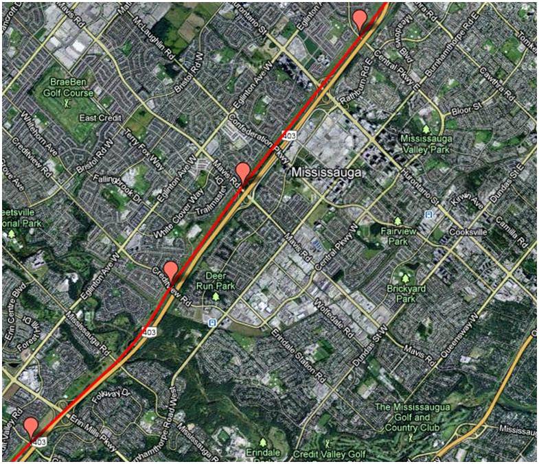
Mississauga
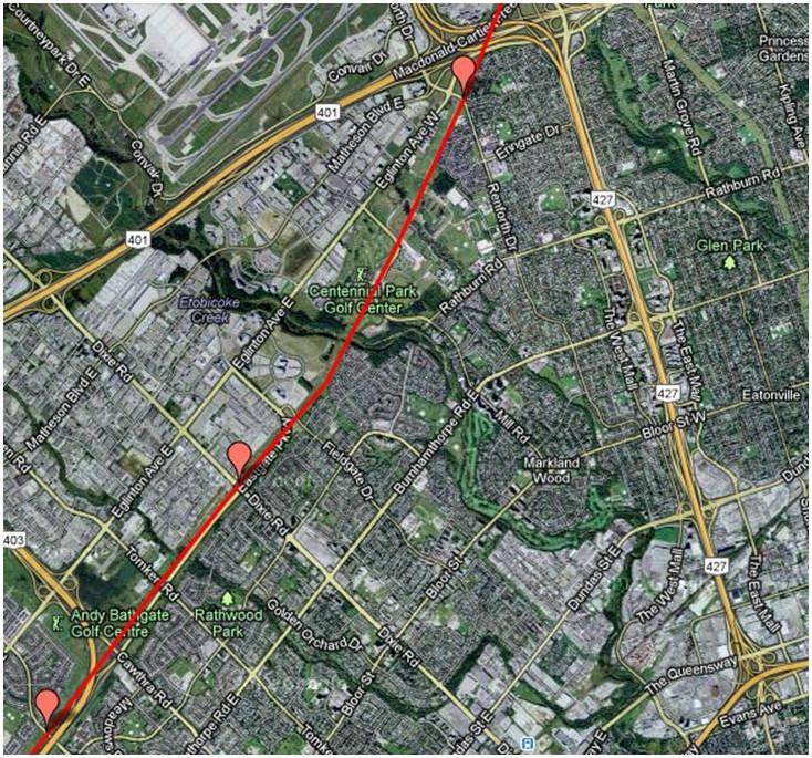
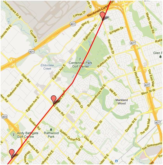
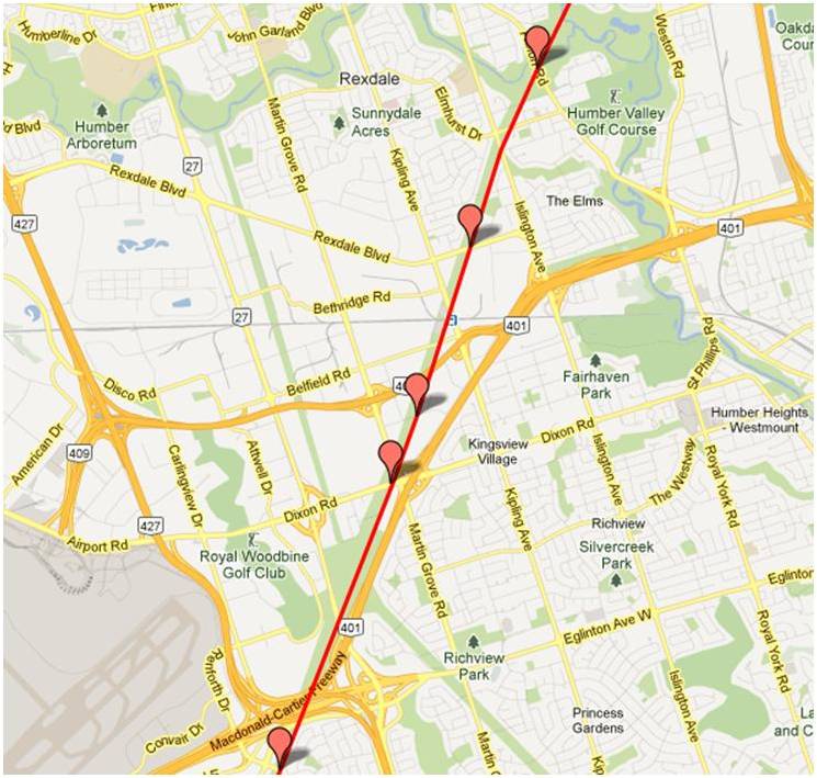
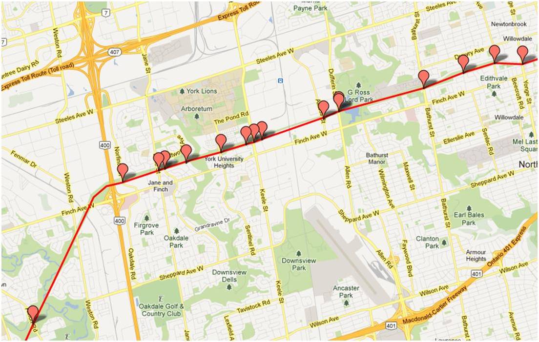
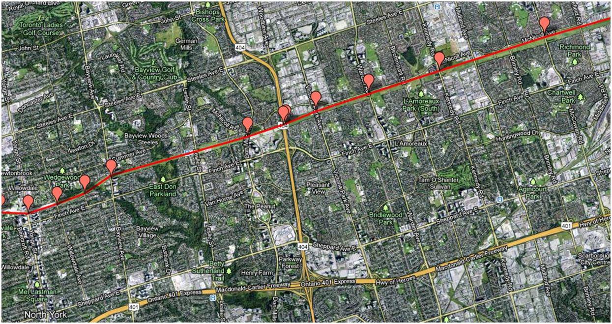
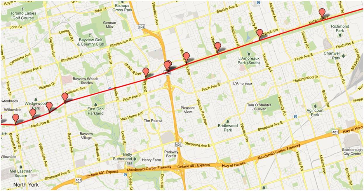
Toronto

Scarborough

Pickering/Ajax
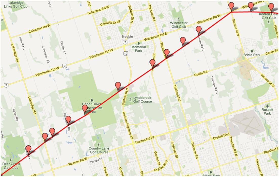
Whitby/Oshawa
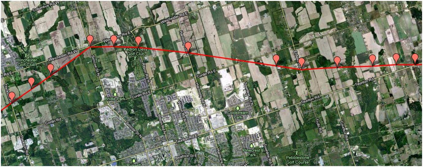
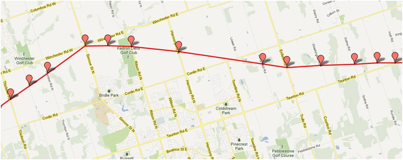
Bomanville/Clarington
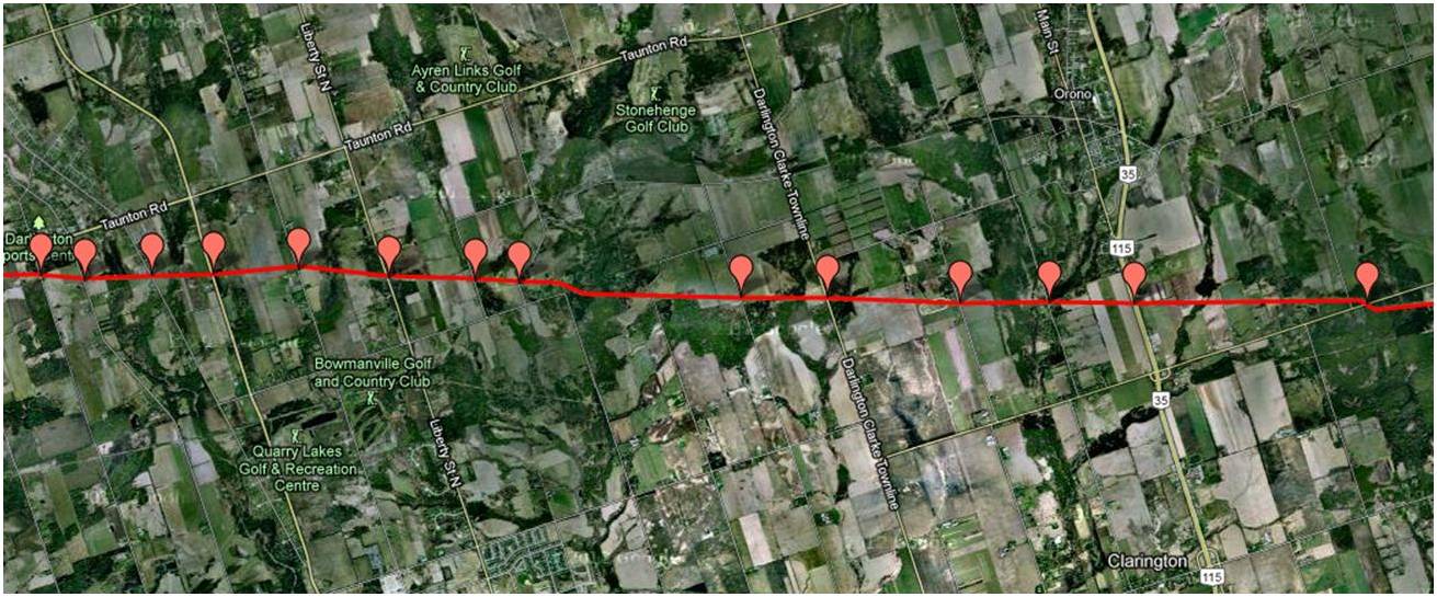
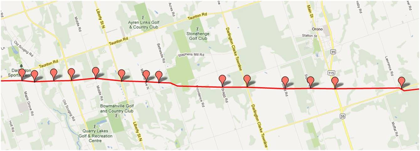
Newcastle/Newtonville


Port Hope

Cobourg
Grafton
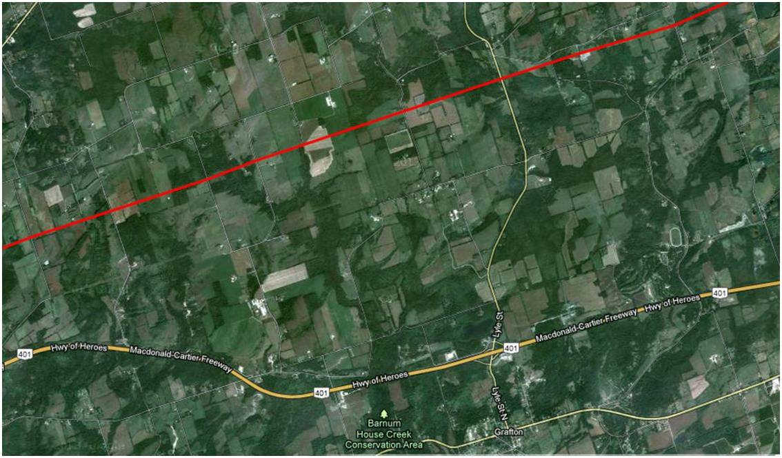

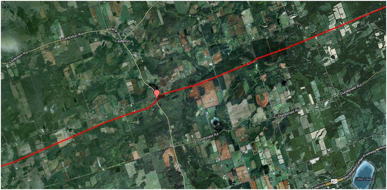
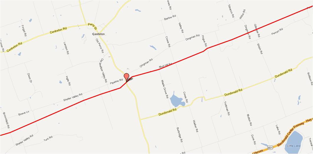
Castleton
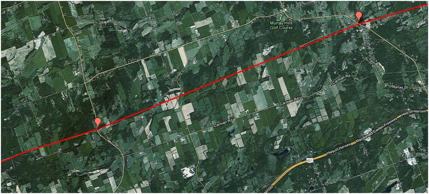
Brighton/Trenton

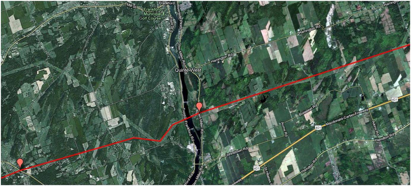
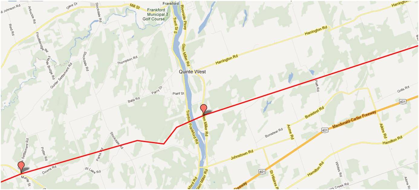
Quinte West
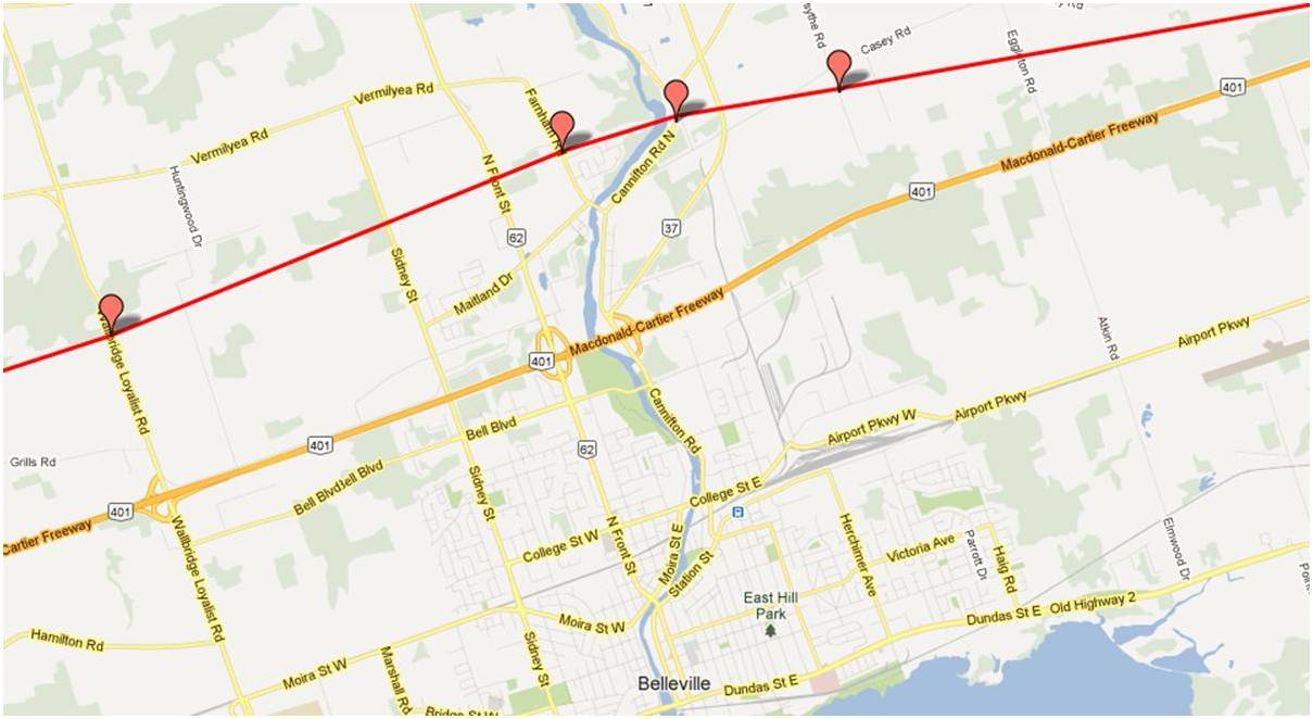
Belleville

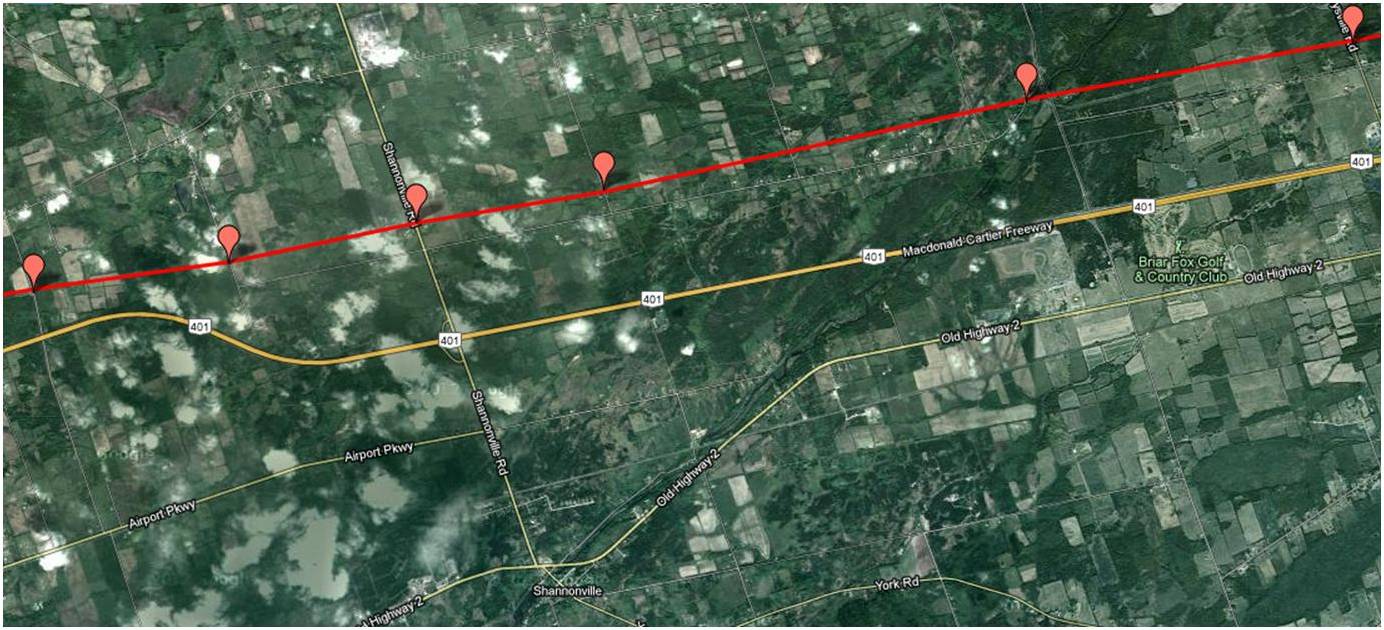
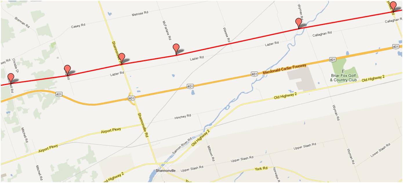
Shannonville
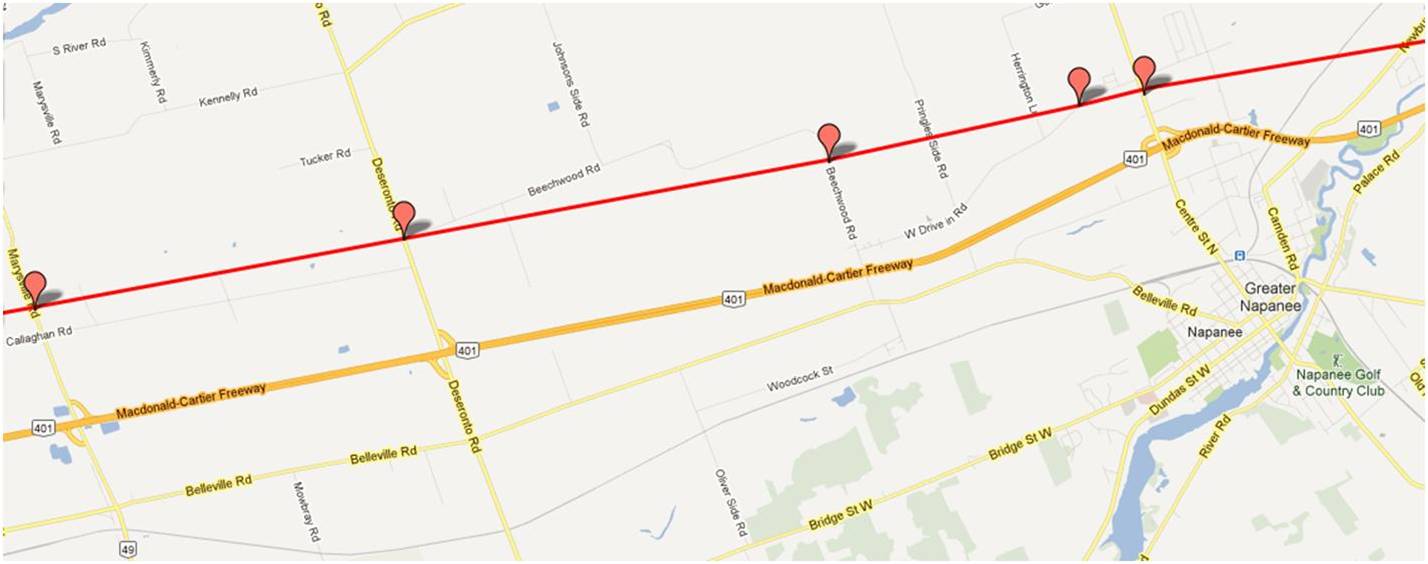
Napanee

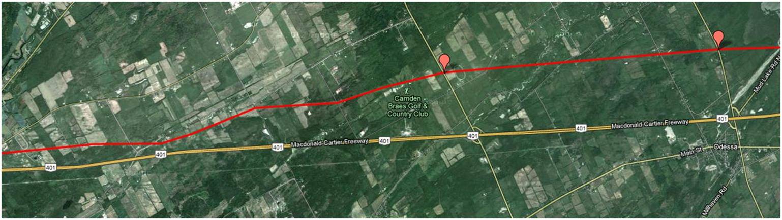
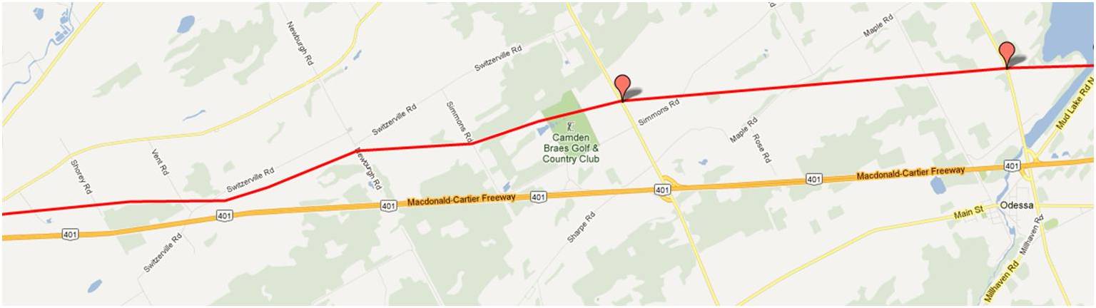
Odessa
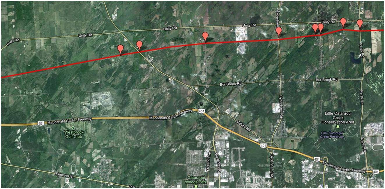
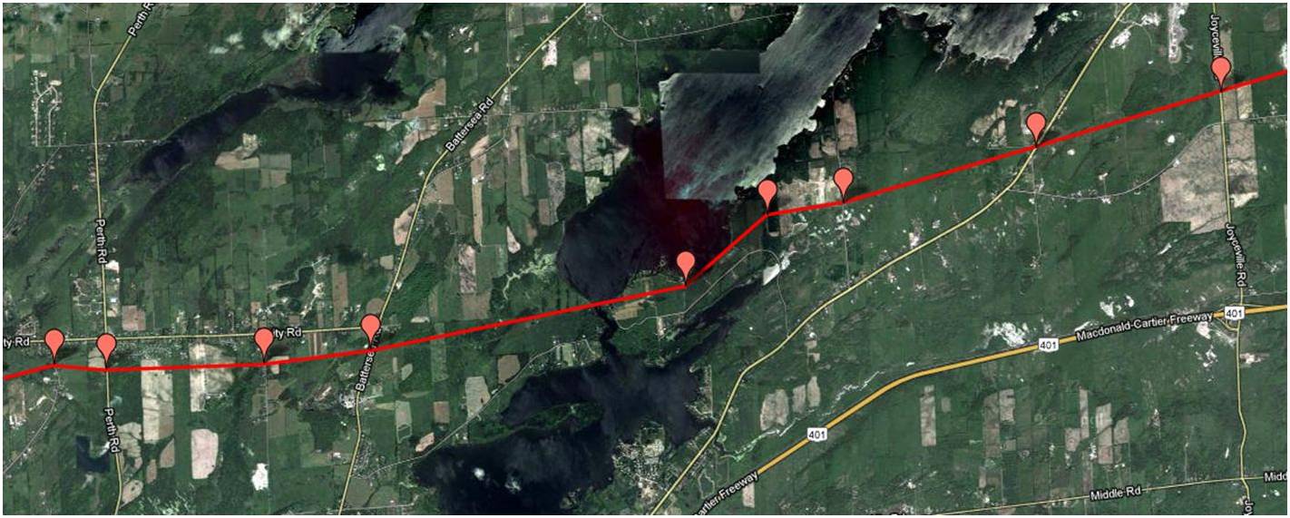
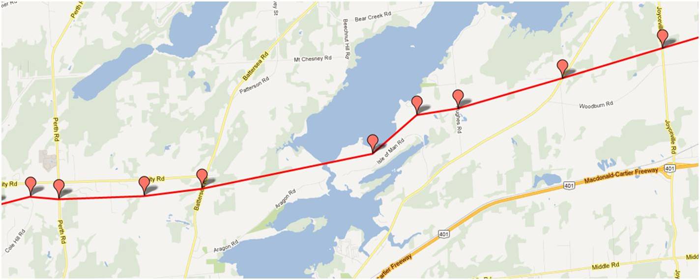
Kingston

Glenburnie/Joyceville
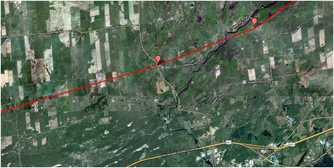
Gananoque
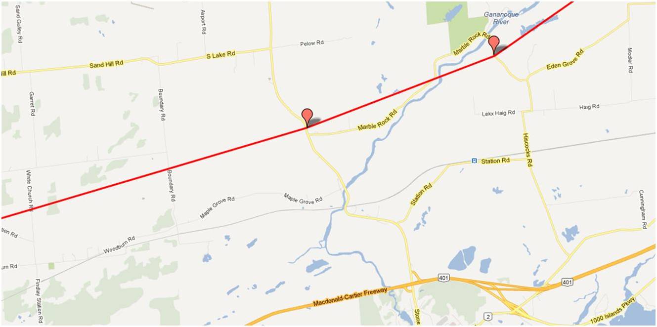
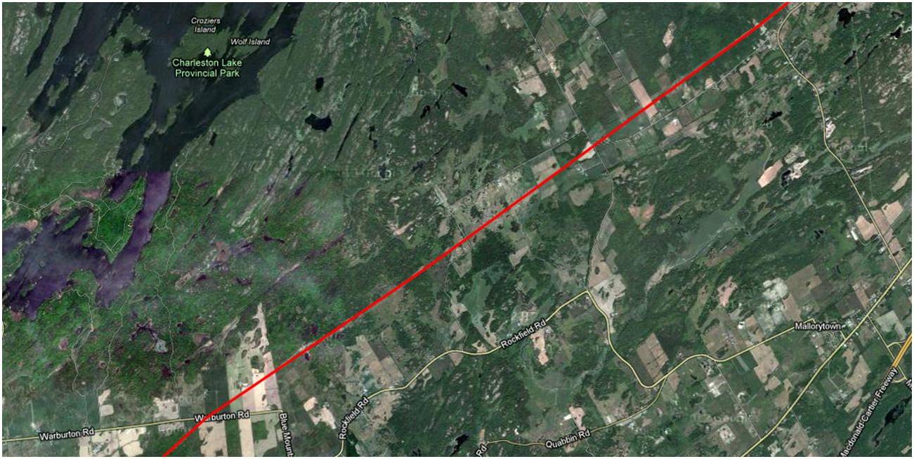
Landsdowne
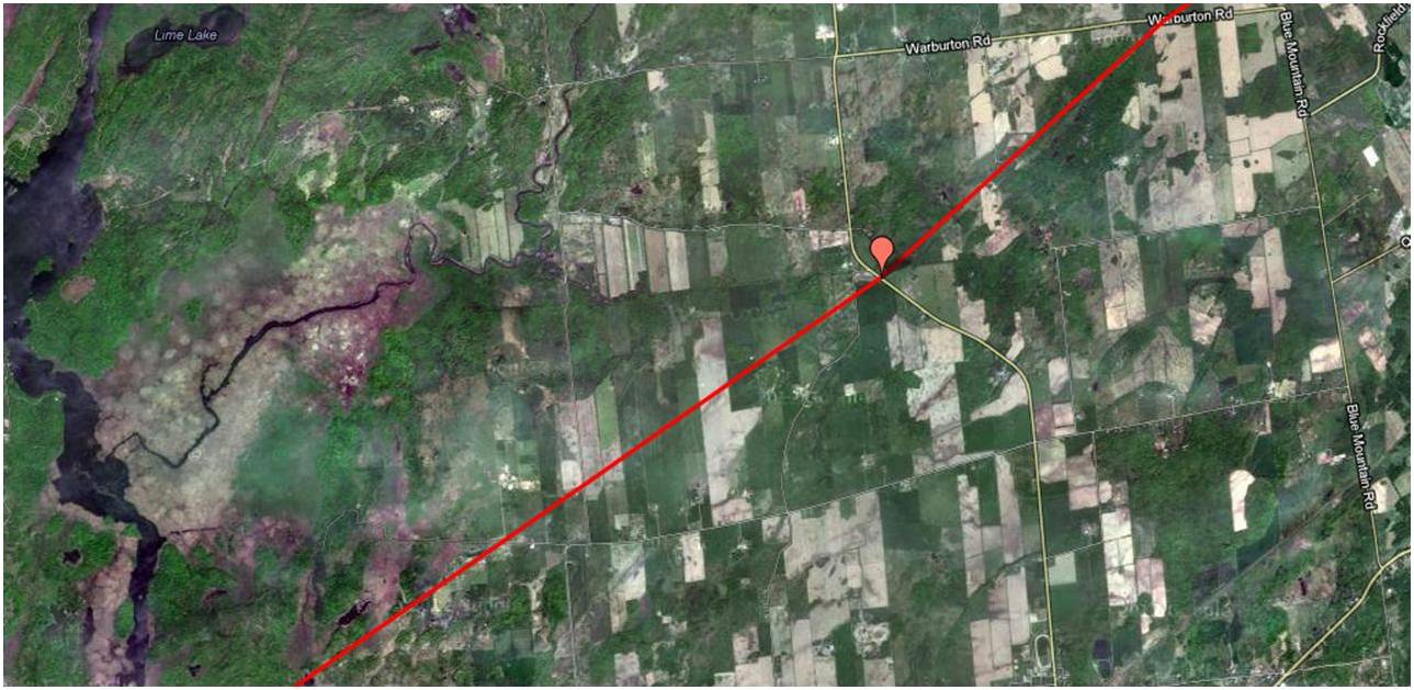
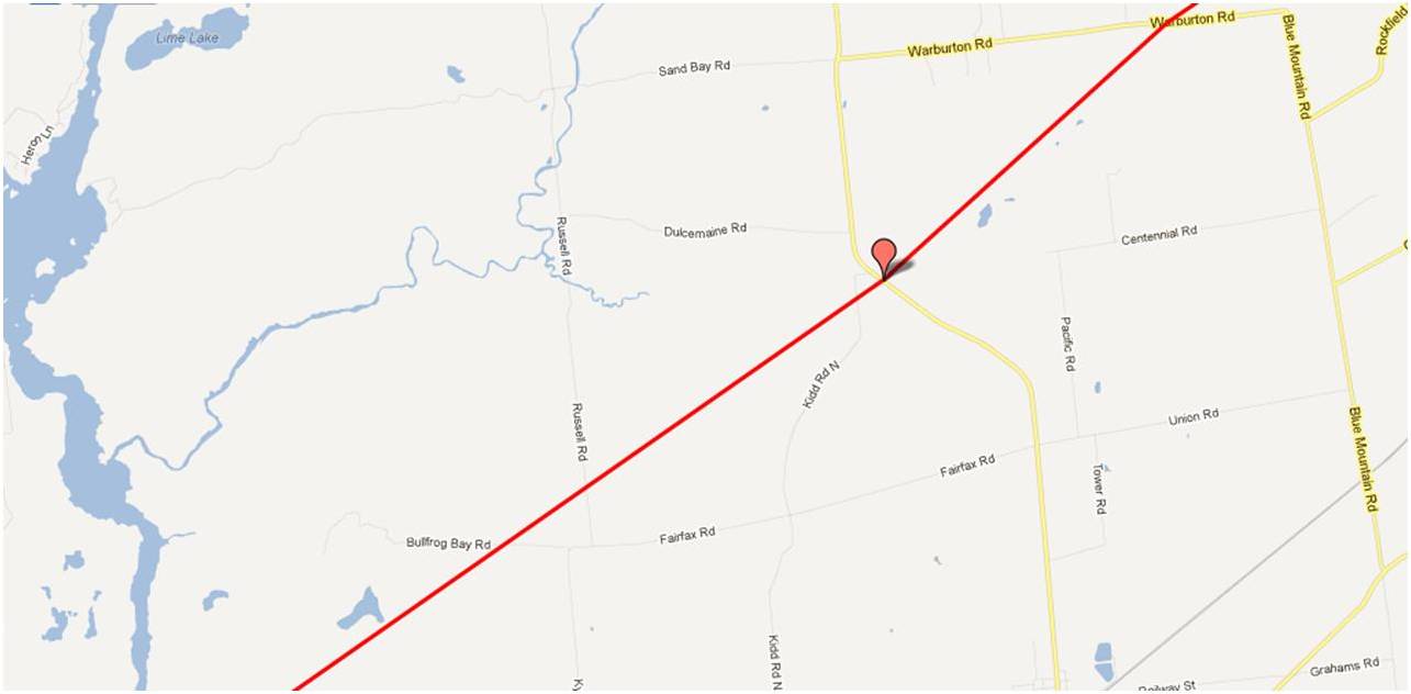
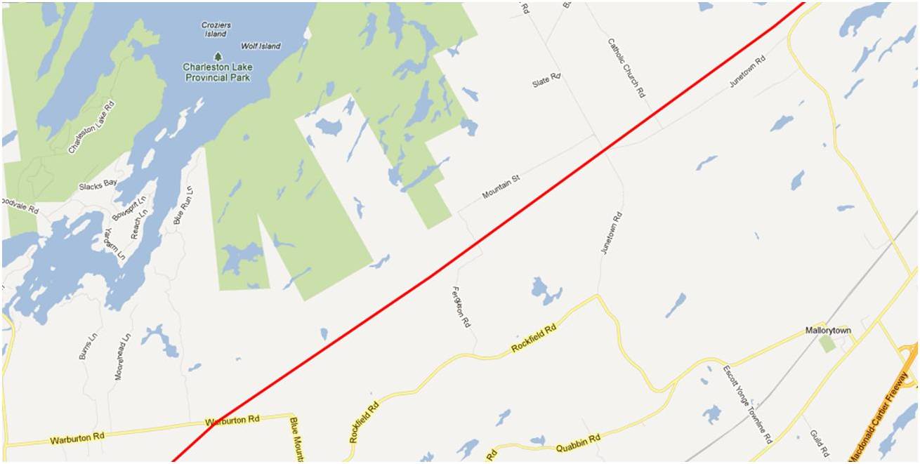
Mallorytown
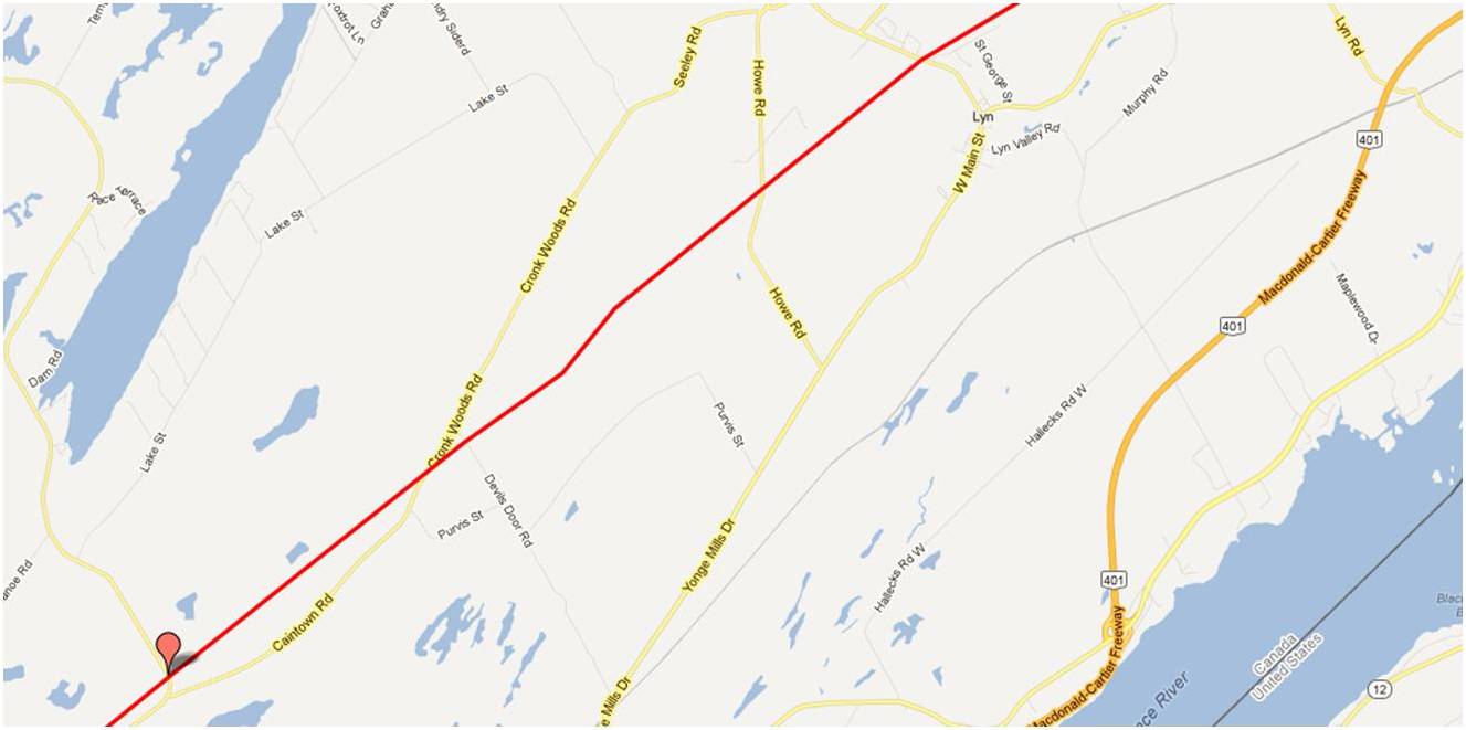
Lyn

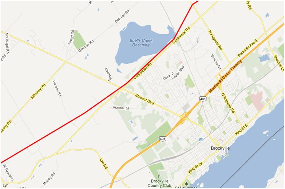
Brockville

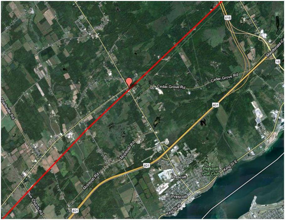
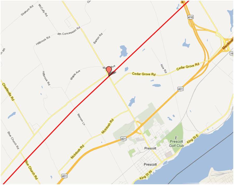
Prescott
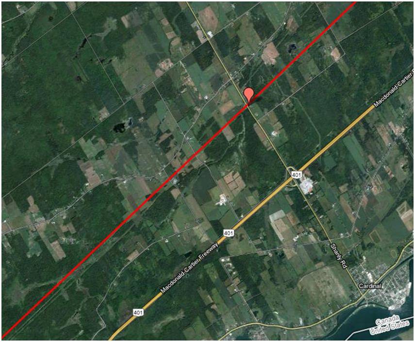
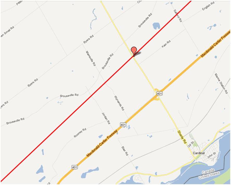
Cardinal
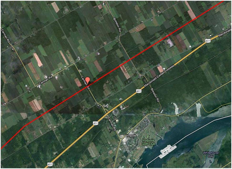
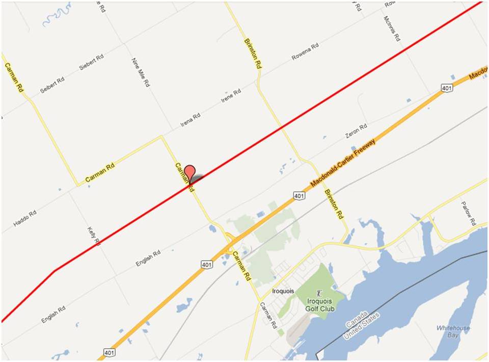
Iroquois
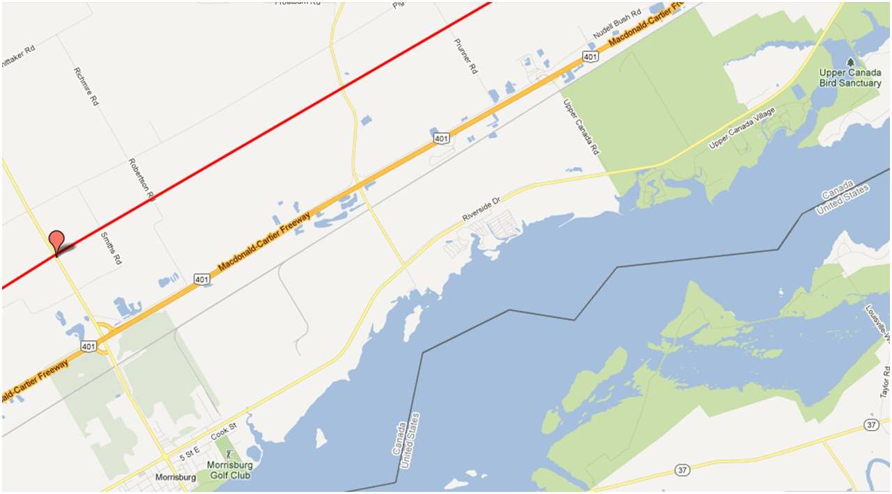
Morrisburg

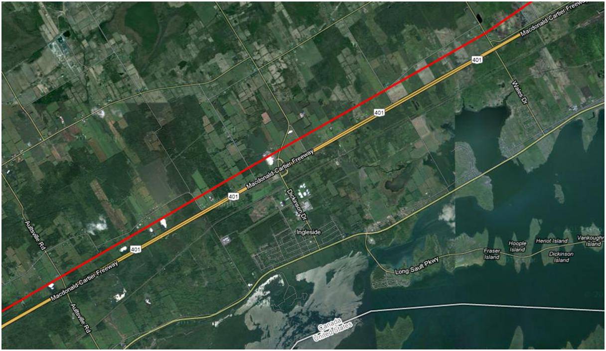
Ingleside

Cornwall
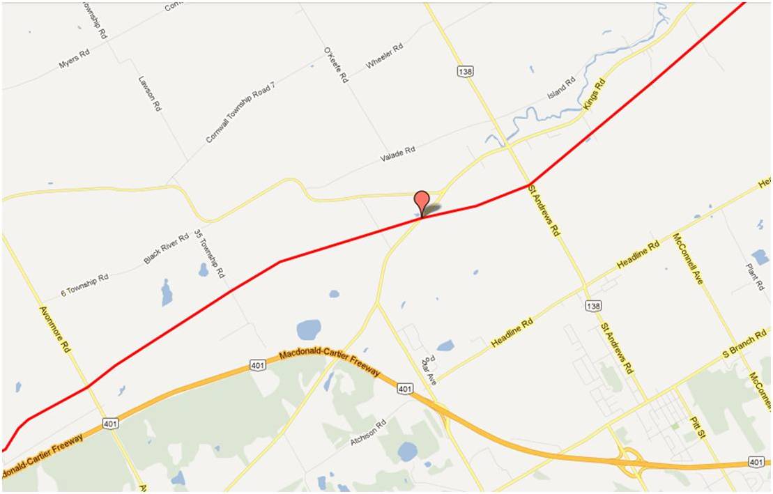
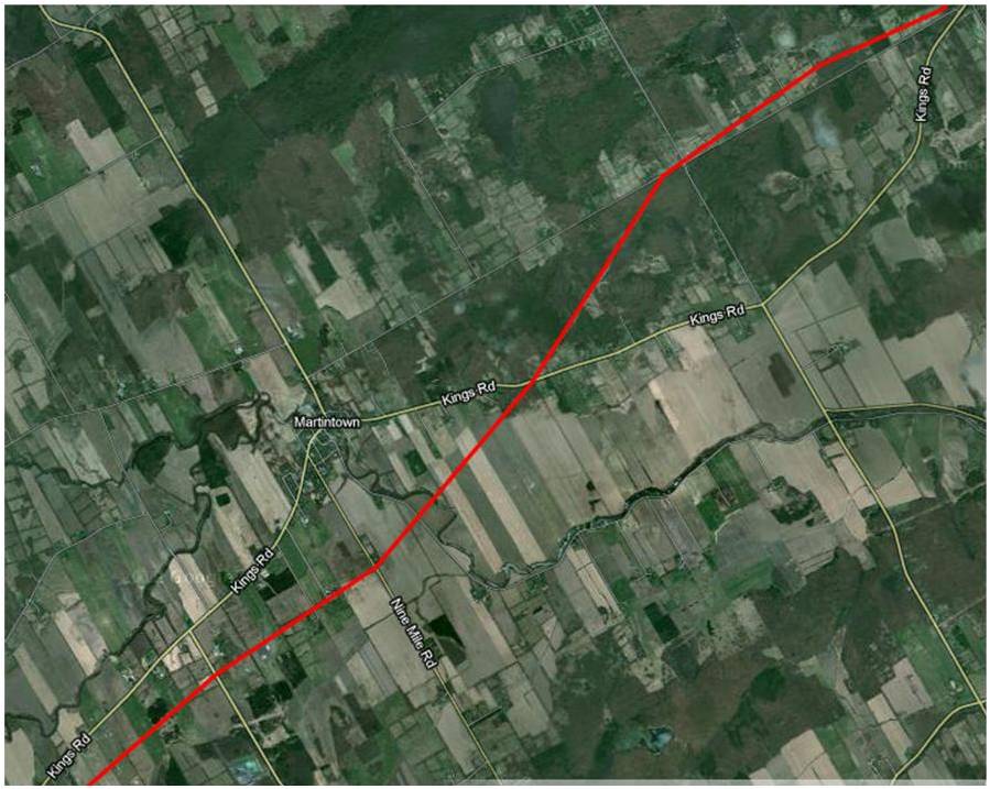
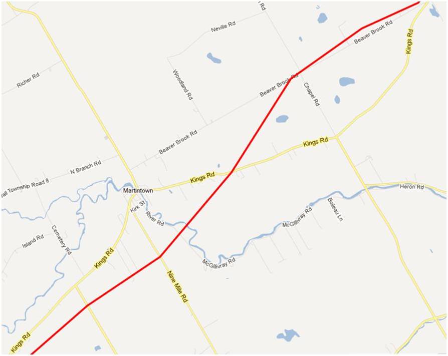
Martintown
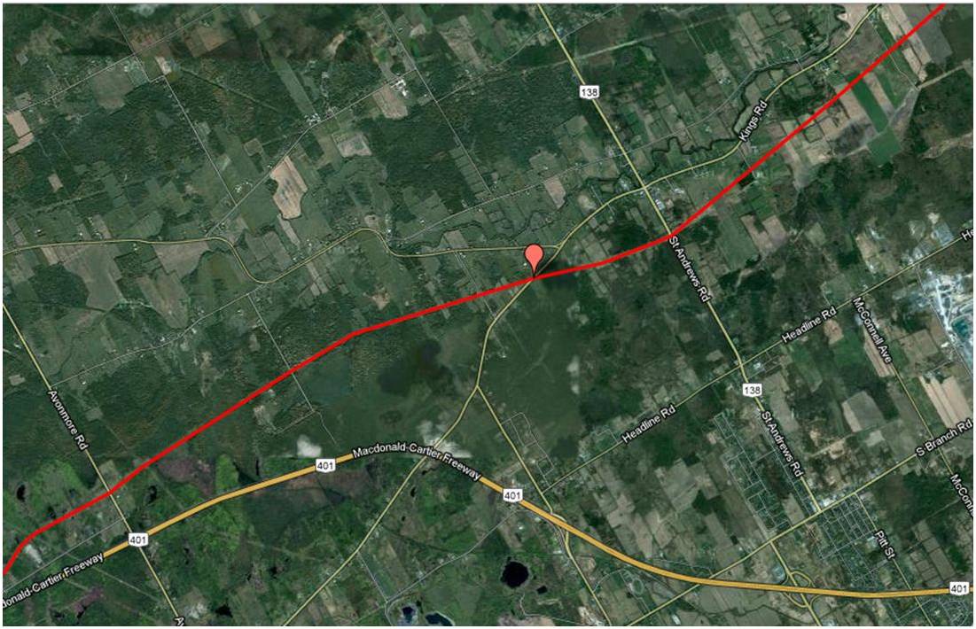
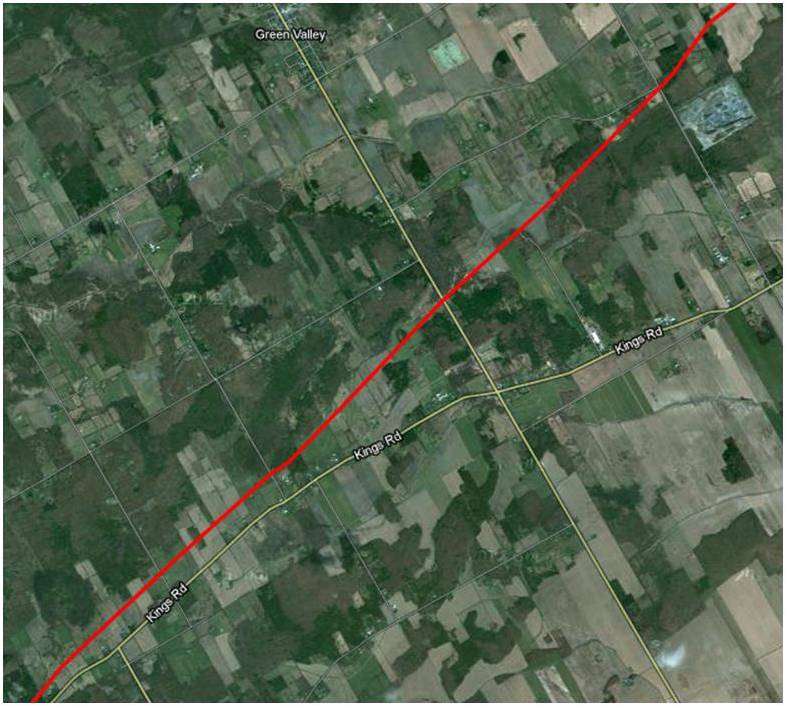
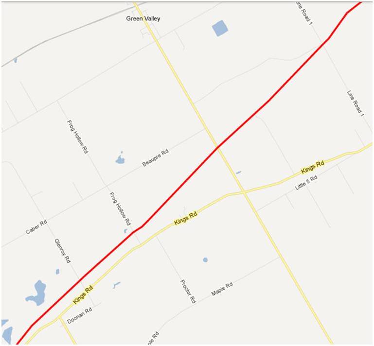
Green Valley
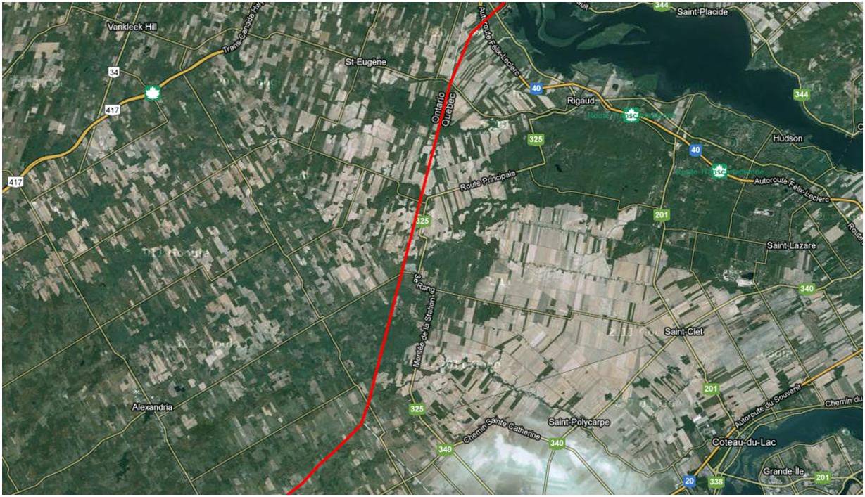
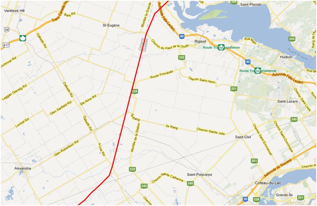
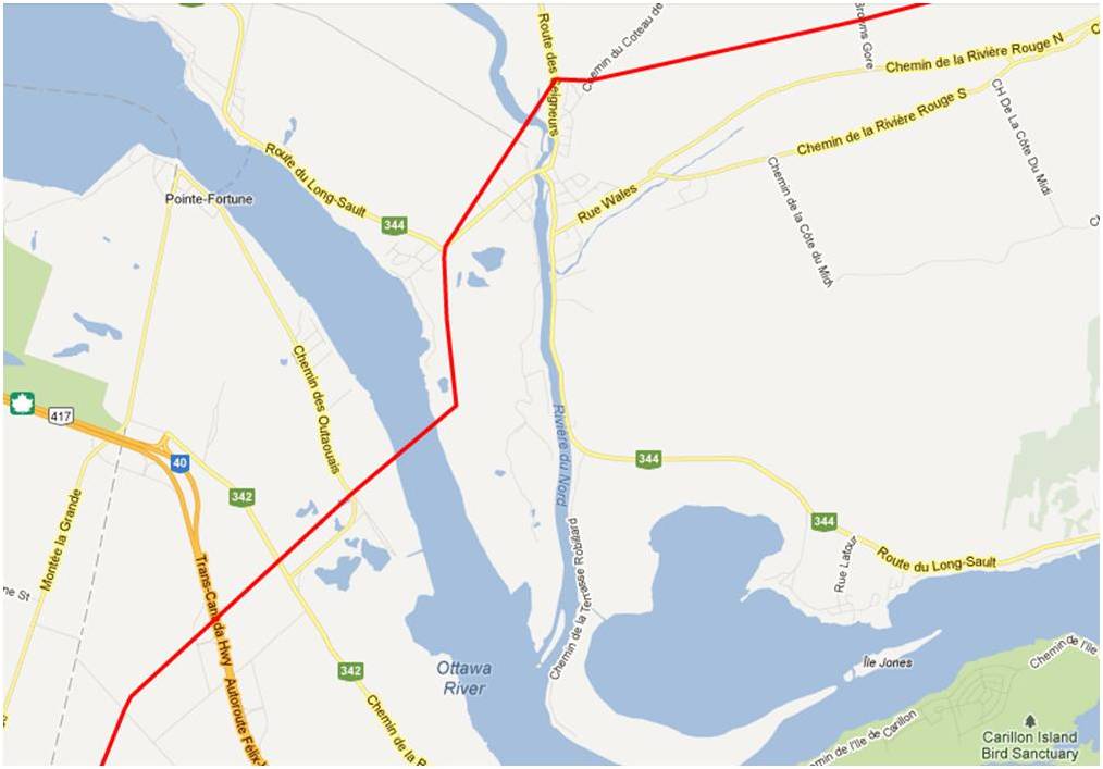
Ontario/Quebec Border
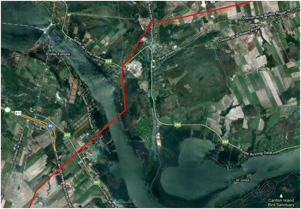
Ottawa River Crossing
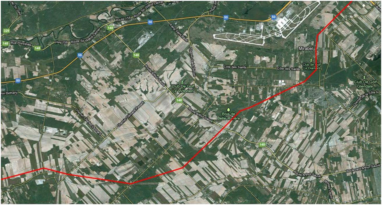
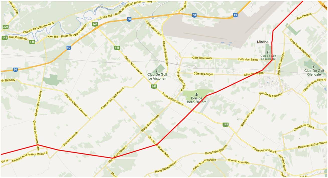
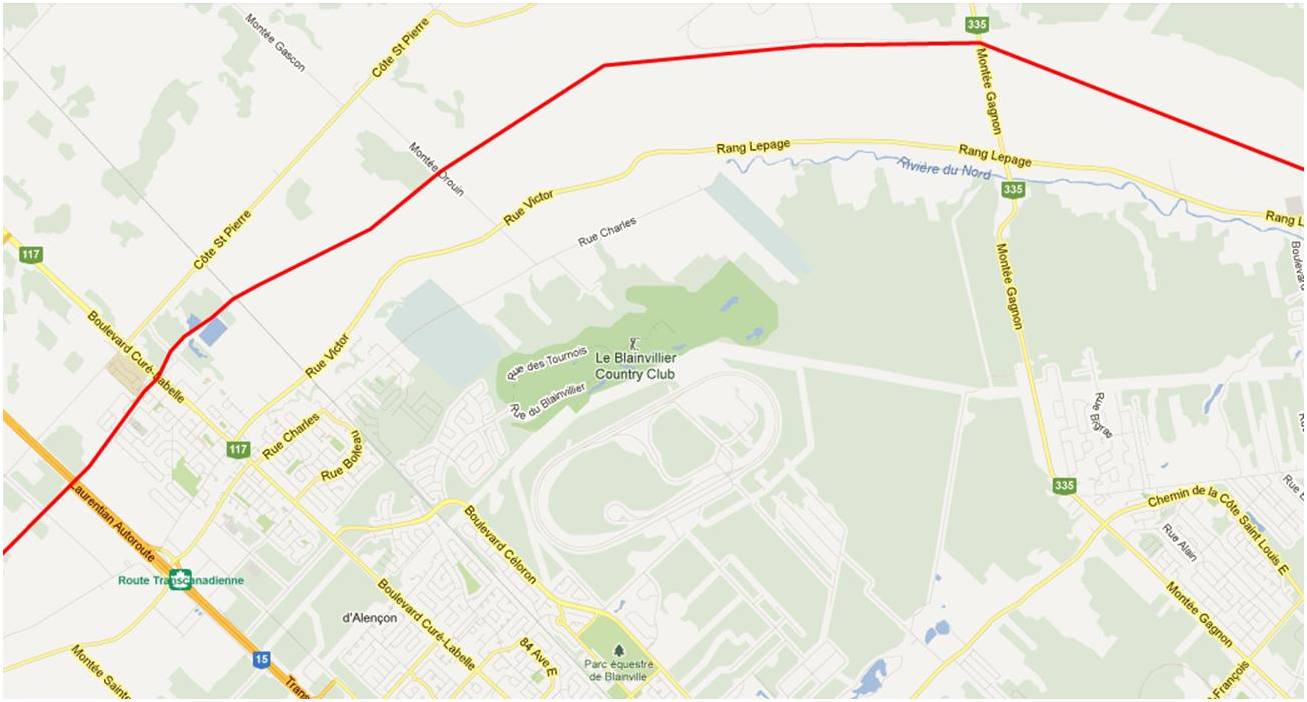
Mirabel
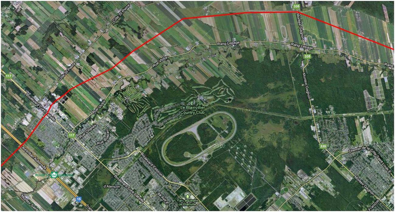
Blainville
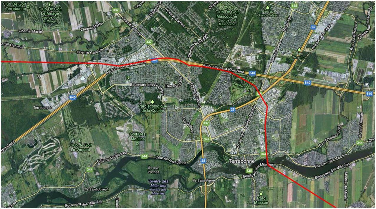
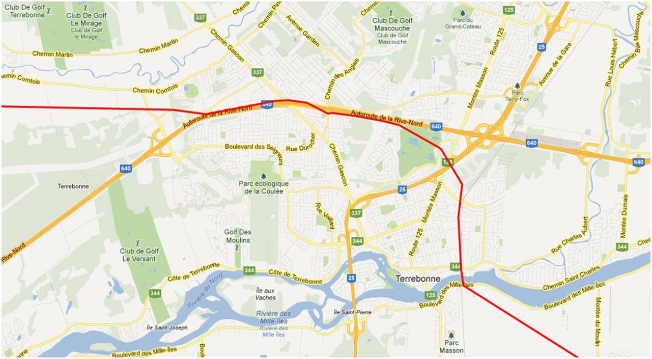
Terrebonne
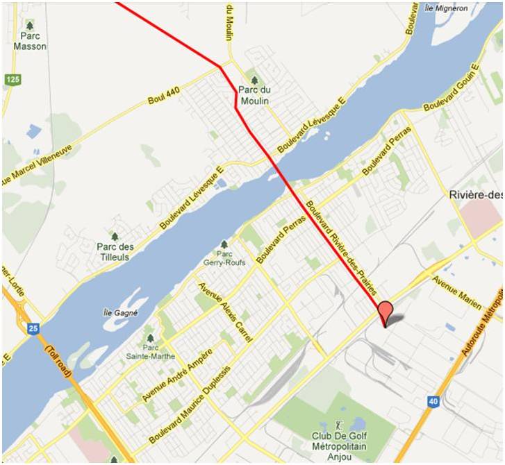
Montreal


Having heard a discussion on CBC of the proposal to use the Enbridge pipeline in a west-east direction to transport heavy oil, I was prompted to go to the web site to check the route. I don’t see a local map of the Brockville/Maitland area and wonder if this could be provided.
Hi Linda,
Thank you very much for your input. We have now posted a Brockville/Maitland map as requested. The line runs between Centennial Rd and Buells Creek Reservoir, going through the solar farm before crossing South Augusta and continuing east just below Stones Corners. Please let us know if you have any further questions and thank you for helping to raise awareness about Line 9.
Many thanks for your prompt response.
Linda
Thank you so much! I learned from your maps that my cousin’s house is within 500 feet! She’s on high ground, but too close to the fumes. I passed the maps on so she can show others.
We’re pleased to hear you’ve found the maps useful! 500 feet is about 150m. Enbridge says that all residents within 200m are considered “neighbours” and are informed about the pipeline location and any changes at least once every three years. We’d be very interested to hear if your cousin has been contacted by an Enbridge official about this project. Thank you for your comment!
Hello,
How do we obtain Enbridge proposed pipe line maps
Which proposed pipeline are you referring to?
Would it be possible to see a map from Bryanston to where the line crosses the Thames River north east of London Ont.
Absolutely! I will email it to you right now.
I would like to see maps (at least one) WEST of Hamilton (Westover). In fact, all the way from Sarnia, if possible. Thank you.
Very good suggestion! I’ve had quite a few requests for this. Starting to compile them this weekend. Thanks for your comment.
Line 9A maps now posted – https://line9communities.com/line-9a/
Very much appreciated. Thank you so much! This is exactly what I was looking for.
do you have a map of London?
Hi Veronica,
You can find maps of the London area here – https://line9communities.com/line-9a/
From Sarnia to Westover, there are 3 Enbridge lines (Line 7,8, and 9) In summer 2013, Enbridge applied for a capacity increase for Line 7.
Is this line9 project in any way related to the TransCanada energy east pipeline project? More specifically in Eastern Ontario, if they are two different pipelines, will they share the same corridor? http://www.energyeastpipeline.com/
Two different projects, but Line 9 and Energy East may share the same corridor through Quebec.
I just learned that I live at less than 1 km of the pipeline ! Thanks guys
Thanks Gabriel! Please share the site.
Is any line passing through Mississauga Rd / Bovaird Dr in Brampton
Yes, it looks like an Enbridge pipeline through there.
both enbridge and transcanada have pipelines running near in that area (they share a corridor there)
Maps are not clickable.